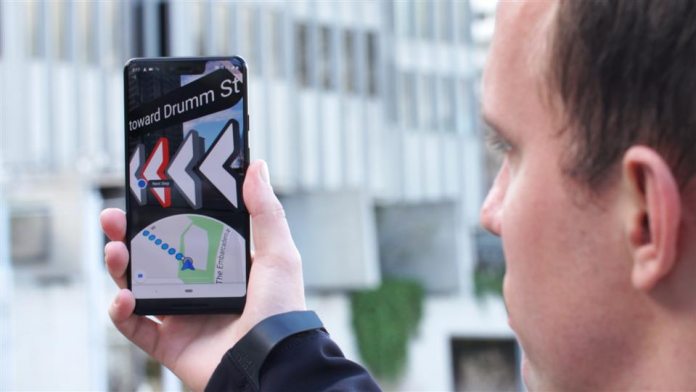
First unveiled at its I/O developer conference last year, the feature allows Google Maps to leverage a device camera for real-time directions. While the feature is still not available yet, David Pierce of The Wall Street Journal has tested it. In many ways, the new ability is akin to what Google was attempting when integrating Maps with its Glass wearable. Writing for WSJ, Pierce says the new AR capabilities are unlikely to become the leading turn-by-turn option for Google Maps. However, it is a “huge step in the right direction”: As usual, Maps collects device GPS data to determine the location of the user. Through Street View, the app displays the directions on the screen for the user to follow. “It was as if Maps had drawn my directions onto the real world, though nobody else could see them,” Pierce explains. When transitioning from the device in camera mode and down facing flat, the app automatically transitions from Street View to normal map. Rachel Inman, Google’s user-experience lead tells that “it’s for those moments like, ‘I’m getting off the subway, where do I go first?’”
Future
Google is seemingly still in development of the feature and is still experimenting with UI tweaks. One problem is not wanting users to be glued to their device and distracted when walking. A line on the ground or animated guide keep users too fixed on the device. Pierce points out he could change interface in the preview. Still, it seems the most likely implementation for the technology is on AR head mounted displays. Indeed, Pierce suggests on a device the real reason to use the feature is because it pinpoints location more accurately. Google did not confirm when the AR integration will go live but did says it will be limited to “a few Local Guides” soon, and “will come to everyone only when Google is satisfied that it’s ready.”


